At Talbot Surveys Inc. we believe that technology is our future and it is the future of surveying. We are continuously upgrading our equipment and our computer programs to stay at leading edge. With technology constantly being improved it allows surveyors to do their job better and more efficient.
Equipment List
Below you will find the complete list and description of equipment available and used by Talbot Surveys Inc.
eBee SenseFly Aerial Mapping Tool
In a single 50-minute flight, our eBee UAV units collect up to 10km² of aerial photography. With a 16MP camera, it captures aerial imagery accurate down to 1.5cm/pixel resolution. The images can be processed to create stunning maps & elevation models with a precision of 5cm.
Postflight Terra 3D allows automatic processing of geo-referenced orthomosaics & digital elevation models (DEM) down to 5cm accuracy (relative accuracy). Ground control points can be used to increase global precision. The final result can be increased by seam-line editing and luminosity adjustment functions.
See our eBee UAV Gallery to see what our units can offer for your next project.
Total Stations
Since Talbot Surveys is involved with a wide-variety of projects, we require a diverse range of equipment. With industry leading technology, we are able to perform highly accurate layouts & surveys. Some of the units Talbot Surveys utilizes are:
- Trimble SX10 Scanner/ Total Station
- Topcon GT-1003 Total Station
- Topcon IS 303 Robotic Total Station
Echo Sounders, Boats, & Motors
In the surveying field, having access to boats is essential. Whether it be for bathymetric surveys or accessing remote waterways, our team always makes safe boating practices the priority.
The CEE ECHO is the newest addition to our wide range of equipment. It is a dual-frequency echo sounder that can further penetrate heavy vegetation & other obstructions to give us an accurate visual representation of the true seabed.
GPS Systems
Talbot Surveys utilizes GPS systems, such as; Topcon Hiper II, HyperLite+, & Altus APS-3. These systems provide our crews with great range, durability, & accuracy to help us produce data for our clients on any project.
Levels
Utilizing Zip Levels, Optical Levels, & Laser Levels we are able to produce, transfer, and monitor elevations with millimeter accuracy.
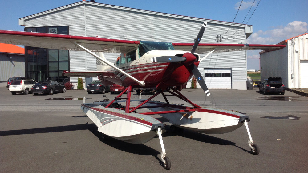
Cessna 206 Aircraft
The Cessna 206 Aircraft is used for aerial photography & to monitor site-specific job progress. Here at Talbot Surveys Inc., we are fortunate to have an aircraft that can access remote areas, as well as travel great distances in little time.